ASSAM
GUWAHATI
Guwahati, the capital city of the northeastern state of Assam, was formerly known as Pragjyotishpur (the City of Eastern Light). Located on the bank of the Brahmaputra River, Guwahati is also the largest city of Assam. This city is also the second largest metropolitan area in entire Eastern India. The gateway to the seven other northeastern states, Guwahati is a vital tourist link point, besides being an attraction in itself.
Temperature:
Summer: 18°C to 37°C; Winter: 7°C to 26°C
Best Time to Visit:
From October to April. The torrential monsoon period (June to September) is best avoided as the swollen Brahmaputra causes havoc in its wake.
Kamakhya Temple – The Kamakhya Temple is a Sati Pith temple situated on the Nilachal Hill in western part of Guwahati city in Assam, India. It is the main temple in a complex of individual temples dedicated to different forms of the mother goddess as the Dasa Mahavidya, including Bhuvaneshvari, Bagalamukhi, Chinnamasta, Tripura Sundari and Tara. It is an important pilgrimage destination for general Hindu and Tantric worshipers.
Kalakshetra – Shankardev Kalakshetra is an Assamese cultural museum in the Panjabari area of Guwahati, India. It includes an art gallery and a children’s park. It is named after the great Vaishnavite reformer of Assam, Shankardeva. The artistic excellence of Assam and rest of the north-eastern region is displayed here.
Balaji Temple – Tirupati Balaji is a magnificent temple at Lokhra, near Guwahati, in Assam. It is dedicated to Lord Venkateswara, and is a holy place for the pilgrims from the north-east. The sanctums of Lord Ganesh, Lord Balaji and Goddess Durga can also be seen here. The architecture of this temple is unique, and takes after the South Indian temples.
Nabagraha Temple – The temple is dedicated to Lord Shiva who is worshipped here in the form of nine shivlings, representing the nine planetary gods of Hinduism. Each shivling is wrapped in a cloth having a specific color. Each of these colors symbolizes one of the nine planets. The temple was built in 1752.
Sukresvara Temple – This temple is situated on the banks of Brahmaputra River. This temple is dedicated to Lord Shiva. It contains one of the largest Linga in India. This temple was constructed in AD 1744.
Assam State Museum – Established in 1940, it is one of the biggest multipurpose museums in the country. The museum has separate sections for archaeology, epigraphy, numismatics and iconography. The collection includes archaeological, wooden and bell-metal objects, ivory, terracotta, pith, tribal objects and dioramas of tribal life. Painting, old textiles, arms and weapons, ethnographic objects and stone sculptures are the other artifacts on display.
River Cruise – A River Cruise on the mighty Brahmaputra is a wonderful opportunity to get a feel of this legendary river. Catch the ferry travelling between Sukheshwar Ghat and North Guwahati or travel a little more stylishly in one of the state tourisms run vessels.
Haflong – Assam’s only hill station, Haflong is 325Km. from Guwahati. Its picturesque and unspoiled environs are perfect for extended stays.
Wildlife:
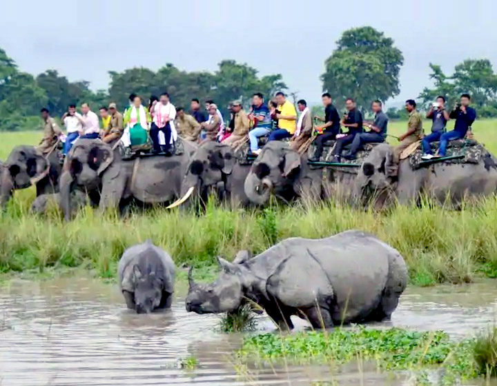
Kaziranga National Park:
In the heart of Assam, located on the banks of the mighty Brahamputra River. It is inhabited by the world’s largest population of one-horned rhinoceroses, as well as many mammals, including tigers, elephants, panthers and bears, and thousands of birds. With Open country covered mostly with elephant grass, Kaziranga gives visitors a chance to see the fauna at fairly close quarters. The total number of rhinoceros in the park is 70 percent of the total population of this species in the world. The values and criteria made Kaziranga National Park to get inscribed in the World Heritage Site List 1985.
Jeep Safari: Jeep Safari available from 1st November to 30th April. Jeep Safari is from 7.30am to 9.30am & 2pm to 3.30pm.
Elephant Safari: Elephant Safari is available from 1st November to 30th April. First ride is from 5.15am to 6.15 am and Second ride is from 6.30am to 7.30am from November to April (unless census may be scheduled).
Range: 1- Kohora (Central) Range. 2- Bagori (Western) Range. 3- Agoratoli (Eastern) Range. 4- Burapahar (Ghoraketi) Range. 5- Panbari Reserved Forest.
Nameri National Park:
Nameri National Park is located in the foothills of the eastern ranges of the Himalayan Mountain Range. The forests are home to a host of different animals. The national park is home to a substantial population of elephants. Some of the other animals that can be seen here are leopards, bisons, wild boars, black bears, giant squirrels, capped langurs and sloth bears. There are a few species of birds that are present here as well. One can see hornbills, wood ducks, plovers, bee eaters and babblers. Safaris can be arranged in the park and this is the best way to see the place. Jeeps and SUVs are used for these safari rides and they are protected on all sides with an iron grill.
The park is also home to evergreen forests and they are lush green for many months of the year. Some of the most popular activities in the park include white water rafting and angling. There are several spots that are ideal for angling. However, one has to obtain permission from the forest department for angling. Families can also swim and sunbathe in certain sections of the park.
Manas National Park:
Manas National Park, a project Tiger Reserve and a World heritage Site, is 176 Km. north-west of Guwahati. Other denizens of the dense jungles here are the one – horned rhinos, tigers, hispid hare, gaurs, pygmy hogs and rare golden langurs. It’s a paradise for birdwatchers for it has a stunning selection of avian life.
Pobitora Wildlife Sanctuary:
Pobitora Wildlife Sanctuary is a wildlife reserve in the Morigaon district of the state of Assam in India. It is located about 30 km east of Guwahati. The Pobitora Wildlife Sanctuary is about 48 km by road from Guwahati. It is a 1-hour drive through a road passing by River Brahmaputra, and a small portion of the village of Mayong. It has a dense population of the Great Indian one-horned rhinoceros. Though the total notified area of the park is 38.80 square kilometres, only 16 square kilometres is the effective rhino habitat. Pobitora was declared a reserved forest in 1971 and a wildlife sanctuary in 1987. It covers flat flood plains and a hillock.
World Heritage Site:
Majuli:
It is the largest fresh Water mid-river deltoid island in the world. It is situated in the upper reaches of the river Brahmaputra in Assam. This Island, with a population of 1.6 Lakhs, majority being tribal, is endowed with rich heritage and has been the abode of the neo-vaishnavite Cultural. The island is a bio-diversity hotspot and has rich ecology with rare species of flora and fauna. Majuli for the past five centuries has been the cultural capital of Assam. The main depositories of cultural and spiritual heritage are the Sattras, which are just like Gurukul (hermitages) of yore. Here up to 400 celibates’ stay for life preserving spiritual and cultural heritage, renouncing worldly desires. From the time of the great Vaishnavite renaissance of 14th and 15th century AD, under Srimanta Sankardeva, Srimanta Madhab Deva and other saints this island became the seat of Vaishnavite religion, art and Cultural. The famous Satriya Nritya (Dance) and Ankiya Bhaona (Traditional Drama) created by Sankardeva are now Internationally acclaimed and Nationally honoured. Majuli is equally famous for Tribal Folk Cultural and Heritage. It is said to be the cradle of Missing and Deori Culturals. Explore in and around Majuli.
Visit – Dakhinpat Satra, Bengenaati Satra, Shamaguri Satra and the Garamurh Satra and also visit – Missing tribal village,
Sivasagar:
Sivasagar, formerly known as Rangpur, was the capital of the Ahom Kingdom from 1699 to 1788. The Ahoms ruled Assam for six centuries, until their kingdom fell to the Burmese in 1819 and their ruling class was all but wiped out. It is full of archeological marvels created by Ahoms. Spome of the famous sight seeing points of SivaSagar is 1) Talatal Ghar 2) RongGhar 3) KarengGhar 4) Shiva Dol 5) JoySagar Tank And Temple 6) Rudra Sagar Tank and Temple
MEGHALAYA
Shillong:
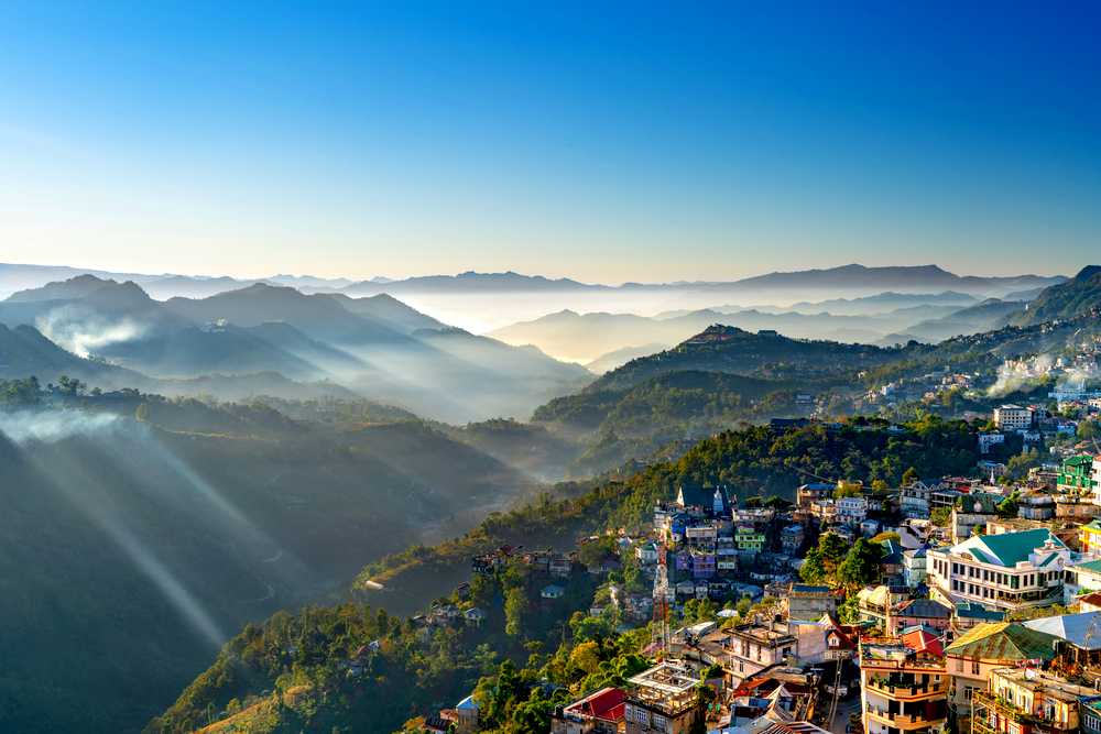
The romantic city of Shilong is one of the important tourist destinations in the northeast. It is often referred to as the “Scotland of the East” due to its striking similarity with the Scottish highlands. Shillong is the capital city of Meghalaya as well as the District headquarter of East Khasi Hills District.
Temperature:
Summer: 15°C to 25°C; Winter: 4°C to 16°C
Best Time to Visit :
From October to June.
Umiam Lake – Umiam Lake, also known as Barapani (Big Water) is a spot around 15 Km from Shillong where a massive hydro-electric dam has been constructed across the Umiam river stream. The Lake is popular for the Water Sport and adventure facilities that it offers. Kayaking, Water cycling / scooting and boating are a few of the facilities available at the Umiam Lake.
Lady Hydari Park – A popular spot both with locals and tourist, it is located in the heart of the city with an abundance of plants and flowers. The best months to see the flowers in bloon are April and October.
Ward’s Lake – A beautiful manmade lake named after Sir William Ward, the then, Chief Commissioner of Assam. A beautiful little lake with short garden walks and boating facilities – this is a popular spot for both local and visiting tourists.
Cathedral Catholic Church – In the heart of the city, there stands a beautiful cathedral of Roman Catholics dedicated to Mary Help of Christian.
Don Bosco Centre for Indigenous Cultures – A three-in-one Institution combining a museum with a research and publication centre, for promoting and preserving the rich cultural heritage of North East India – a unique fusion of all the sister states under one roof. Its seven floors represent the seven states of North East India.
Golf Course – Shillong Golf Course one of the oldest and best natural golf course in the world is considered to be the “Gleneagle of the East” by the United States Golf Association and Museum. The site where the Golf Course is located provides a scenic view. It was set in an undulating valley covered with thick groves of pine and rhododendron trees at an altitude of 5200 ft in 1898 as a 9 (nine) hole course and later converted into a 18 (eighteen) hole course in 1924.
Elephanta Falls – 12 kms on the outskirts of the city the mountain stream descends through two successive falls set in dells of fern-covered rocks.
Shillong Peak – An ideal picnic spot, 1965 metres above sea level and 10 kms from the city, offers a panoramic view of these country side, and is also the highest point in the State.
Dawki – About 96Km from Shillong, Dawki offers gorgeous views and continues to be a popular picnic point.
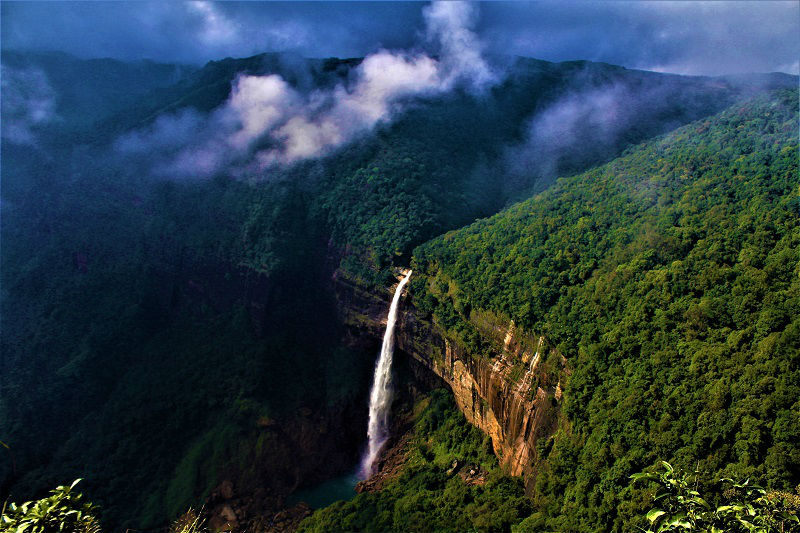
Cherrapunji (Full Day) – Cherrapunji is Located on the eastern side of India, Cherrapunji has pristine beauty, as these hills are not yet exploited. It is the only place in India that experiences monsoon throughout the year. High above the hazy valleys and foaming rivers, hidden in the rolling clouds and perched on an headland, lies Cherrapunji, 4,500 ft above the sea level. Cherrapunji, locally and officially known as Sohra, in the north eastern state of Meghalaya is a spectacular location with the year-round rain. This is a stunning location and the year-round rain earned Cherrapunji coveted entry long ago into the Guinness Book of World Records as the wettest place on earth, the place where the rainfall can be recorded in feet rather than in millimeters. In Cherrapunji you can see Nohkalikai Waterfalls, Eco Point, Mawsmai Caves.
Mawsynram (Full Day) – The winding roads of the hilly terrain with scenic view of the picturesque snow-covered ranges, orchids blooming over treetops and gentle streams rushing out to meet roaring waterfalls, are breathtaking for every wanderlust who make their way to Mawsynram. Another breathtaking, wondrous place of Meghalaya, Mawsynram is a small village in the Khasi Hills about 56 kilometers from Shillong. It is reportedly the wettest place recording the highest rainfall of 11.872 meters but since it has no meteorological department in the area, Cherrapunji is still officially considered the place recording world’s highest rainfall.
Mawlynnong (Full Day) – Mawlynnong Village has earned the distinction of being the cleanest village in India. It is situated 90 kms. from Shillong and besides the picturesque village, offers many interesting sights such as the living root bridge and another strange natural phenomenon of a boulder balancing on another rock. Mawlynnong nestled in the pristine hill state of Meghalaya, is along the India-Bangladesh border. This cute and colourful little village is known for its cleanliness. Discover India magazine declared the village as the cleanest in Asia in 2003.
Everyone makes it a point that dirt and waste are not thrown everywhere. All the waste from the dustbin is collected and kept in a pit, which the villagers use as manure. The villagers are now on a mission to ban plastic. The village with cent per cent literacy is conscious and they are spreading the message of conservation and protection of the forest. Locals plant trees to ensure that the virgin forest is kept intact and also replenished.
ARUNACHAL PRADESH
Temperature:
Summer: 25°C to 35°C; Winter: 1°C to 15°C
Best Time to Visit:
From September to May
Bhalukpong:
The main places of interest in Bhalukpong are the picnic spots along the charming Kameng River and the nearby forests. Travelers can enjoy the panoramic view of the mountains surrounding Bhalukpong and its environs. There are a number of trekking and hiking trails in and around Bhalukpong. Adventure seekers can enjoy fishing and angling along different stretches of Kameng River.
Bomdila:
This small town is famous for Buddhist Gompas and the magnificent view of the Kameng Valley. The view of clouds gathering at the top of the Nechipu Pass can be easily seen from the highest point of this place. The area is also home to the Kangto and Gorichan peaks, which are considered as the highest peaks in the state. Bomdila is also famous for apple orchards.
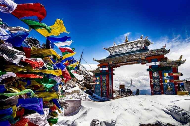
Tawang:
Tawang is birthplace of 6th Dalai Lama, is one of the most beautiful places in Arunachal Pradesh. The destination is located at a height of around 11,500 ft. above sea level. Tawang shares its border with Tibet in north, Bhutan in south-west and Sela range in east.
It is believed that the place has derived its name from one of the oldest and largest Buddhist monasteries in India, Tawang Monastery. Tawang Monastery is an important learning centre. About 400 years old, the monastery is believed to be home to more than 700 monks.
The ever-windy Sela Pass, located about 13,700 feet above sea level on the eastern Himalayas, is said to be among the most difficult airspaces to negotiate even for the most experienced pilots.
Bum la Pass:
The Bum La Pass is located about 37 km away from Tawang in Arunachal Pradesh, at the Indo-China border. An old traders road went from Tawang via Milakatong La Pass (La in Tibetan means mountain pass) to Bum La Pass and finally to Tsona Dzong in Tibet. A special permit is required to visit Bum La Pass. The Permits can be requested at the Office of the Deputy Commissioner in Tawang District, and the same has to be stamped in the Indian army cantonment of Tawang. It is also to be noted that without the army stamp, you will not be allowed through the numerous check posts on the way.
Madhuri Lake – Surrounded by lush pine groves, the picture postcard Shungetser Lake in Arunachal Pradesh’s, Tawang district was the perfect location for Bollywood diva Madhuri Dixit to sing “Tanhai tanhai tanhai…” in the film “Koyla”. The first Bollywood movie to be shot in pristine Arunachal attracted droves of tourists to Shungetser, a sacred lake for the Buddhist Monpa tribe of Tawang. However, after the film’s shooting in 1996, the lake lost its original name. The notorious tour guides sold it to the tourists as Madhuri Lake, after the filmstar.
Dirang:
Dirang is situated between Bomdila and Tawang in Arunachal Pradesh. Dirang is an ideal getaway in West Kameng district with beautiful apple orchards and sheep breeding farms. Attractions of Dirang includes Kalchakra, Ngingmapa Monastery, Yak Research Center, Sangti Valley, Hot spring, Kiwi and Aapple orchards.
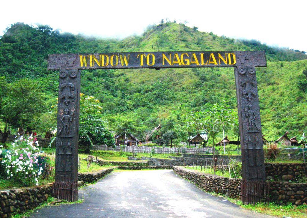
NAGALAND
Temperature:
Summer: 31°C to 16°C; Winter: 24°C to 4°C
Best Time to Visit:
The ideal time to visit is from November to March.
Kohima
Kohima, is a hilly district of India’s North Eastern State of Nagaland, sharing its borders with Assam State and Dimapur District in the West, Phek District in the East, Manipur State and Peren District in the South and Wokha District in the North. Originally known as Kewhira, it was founded in 1878 when the British Empire established its headquarters of the then Naga Hills. It officially became the capital after the state of Nagaland was inaugurated in 1963.Kohima is the land of the Angami Naga tribe. It is situated in the foothills of Japfu range located south of Kohima District and has an average elevation of 1261 metres (4137 feet).
Khonoma village – Khonoma village lies 21 kms away from Kohima town. This is the first “green village” of Nagaland. The village is well known for the legendary leader Angami Zapu Phizo who was the founder of the Naga movement. It is in this place where the Naga warriors made their last endeavor against the British aggression in 1879. Khonoma village houses nature’s pristine beauty in the form of its alder trees, terraces carved out of its hilly slopes and the Khonoma Nature Conservation Tragopan Sanctuary (KNCTS). KNCTS conserves a large variety of rare species of plants and animals within its 25 sq km area. This is almost a virgin territory for birdwatchers, animal watchers and botanists who have the entire area to explore and discover.
Kohima War Cemetery – Kohima War Cemetery constructed in the memory of the officers and soldiers who made supreme sacrifices during World War II, the war cemetery attracts hundreds of visitors every year including the relatives of those martyrs. Maintained by the Commonwealth War Graves Commission, the cemetery witnessed more than 2000 graves, on each grave there are beautiful epitaphs carved in bronze. A fitting prelude to a British soldier who died here reads: “When You Go Home, Tell Them of Us and Say, For Your Tomorrow, We Gave Our Today”.
Dzukou Valley – Dzukou Valley is the lesser known (but no less beautiful and bio-diverse) valley of flowers in India after Nandan Kanan in Uttarakhand. An altitude of 2438.4m, rivulets shaped like the curves of Venus, flowers, herbs and shrubs are the elements that constitute the vibrant diversity of this valley. It offers some of the best trekking circuits in the country, while housing ‘communitised’ villages.
State Museum – For the tourists, there are historical artifacts, log drums, tools & implements, old Naga currencies, attire of warriors, dresses & costumes all preserved here. This museum provides a bird’s eye view of the fifteen colourful tribes at close quarters.
Kohima Zoo – The Kohima Zoo or the Zoological Park is one of the most well-maintained zoos in the country and serves as a great attraction for tourists coming to Nagaland. Built on a hill, the natural landscape offers a comforting habitat to the animals and birds. The hill has been innovatively utilized creating free spaces where the animals have been housed. It is an ideal place to trek and enjoy the magnificent flora and fauna of Nagaland.
The biggest attraction in the zoo is the rare Tragopan bird which is the state bird of Nagaland. It is a highly endangered species with an estimated 500 remaining. Apart from the Tragopan bird other attractions in the Kohima Zoo include ‘Mithun’ a species of the wild buffalo which is also the state animal. Tourists can also catch a glimpse of the Golden Languor and Asiatic Black Bear in this zoo apart from many other wild animals.
Dimapur
Dimapur is the ancient capital of the Kachari tribe, whose rule existed before the 13th century AD. Reminiscences of the glory of this kingdom can be found in the ruins that are scattered in and around the town. These ruins give evidence of a culture that probably had a touch of Hinduism, but were predominantly Non-Aryans. Besides monoliths, Dimapur contains other ruins of temples, embankments and baths. The District draws its name from the Kachari dialect; ‘di’ – meaning river, ‘ma’ – meaning great or big, and ‘pur’ – meaning city, together connoting ‘the city near the great river’. That the Kachari kingdom flourished in Dimapur in the days of old is evident from the existence of the Kachari Rajbari Fort ruins, housing the ancient stone monoliths, and the many excavated tanks dug by the royalty known even today as the Rajpukhuri, Padampukhuri, Bamunpukhuri, Jorpukhuri etc. to name a few. The monoliths represent the elaborate rituals of the cult of fertility.
MANIPUR
Temperature:
Summer: 13°C to 29°C; Winter: 4°C to 25°C
Best Time to Visit:
From October to March.
Imphal
Imphal is capital of Manipur and is one of the most ancient cities in India. Situated 786 m above sea level, Imphal is known for its scenic landscapes and greenery. Manipur is a land of many tribes and Imphal is the cultural capital of the state. It derives its name from ‘Yumphal’, which means ‘land of many villages’ and its landscape is a mix of hills, valleys, forests and several rivers like Iril, Sekmai, Thoubal and Khuga.
Kangla Fort& Kangla Museum – This fort is known as Palace of Kangla belongs to King Pakhangba and surrounded on three sides by lake on the banks of the river Imphal. It is closed in Wednesday.
Govindajee Temple – A historic centre for Vaisnava culture having simple and beautiful structure with gold domes having deity in the centre is flanked by idols of Radha Govinda, Balaram and Krishna.
Mahabali Temple – Dedicated to Hindu deity Lord Hanuman, Mahabali temple is located in the midst of Mahabali jungle –a region inhabited by hundreds of monkeys. Situated in close proximity to the Imphal River, this popular place of worship is visited by devotees and tourists alike.
Imphal Museum – It is located near the Imphal Polo ground has a fairly good display of the state’s heritage and a collection of portraits of Manipur’s former rulers having Items of special interests like costumes, arms and weapons, relics and historical documents.
Second World War Cemeteries – Among the two Second World War cemeteries in Imphal as maintained by the Commonwealth War Graves Commission, the first one, the Imphal War Cemetery, contains some 1,600 graves of Commonwealth soldiers, including Indians, Britons, Australians, Canadians, and East Africans. The second cemetery is the Imphal Indian Army War Cemetery which contains 828 graves, most of which are of Muslim soldiers of the British Indian Army. The cemetery also includes the Imphal Cremation Memorial which commemorates 868 Sikh and Hindu soldiers who were cremated.
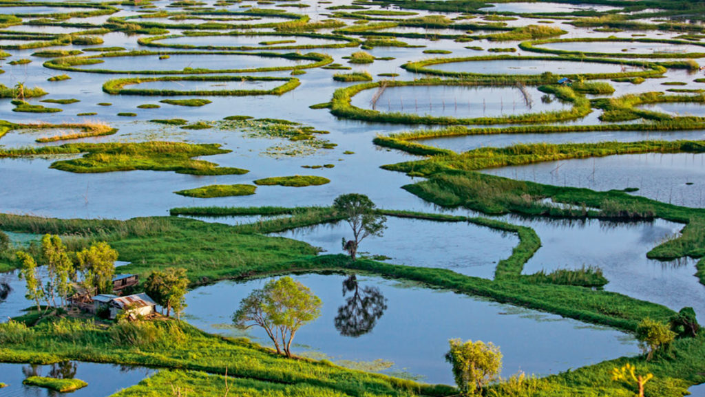
Loktak Lake – The largest freshwater (sweet) lake in North -East India, also called the only Floating lake in the world due to the floating phumdis (heterogeneous mass of vegetation, soil, and organic matters at various stages of decomposition) on it, is located near Moirang in Manipur state, India.
Moreh – A busy border town Moreh lies along the Indo – Myanmar border, 110Km from Imphal. Its’s the perfect destination for the shopping enthusiast. Indo – Burmese (Myanmar) cross – cultural influences from ancient times are richy evident in the lovely environs of Tamu, located just 5Km away.
Keibul Lamjao National Park – Keibul Lamjao National Park is sharing the border with Loktak Lake, the last natural habitat of the endangered marsh-dwelling brow-antlered deer of Manipur called “Sangai”. It is the only floating national park in the world.
MIZORAM
Temperature:
Summer: 18°C to 29°C; Winter: 11°C to 24°C
Best Time to Visit:
From October to March.
Aizawl
Aizawl, the scenic capital of Mizoram, with its surrounding area and the rest of the state have been developed to meet the influx of domestic and foreign tourists. Surrounded on the east by the deep green valley of river Tlawng and protected by beautiful high hills of Durtlang on the north, it is an ideal hill station for those looking for fresh clean air and solitude.
Durtlang Hills – It is situated on the northern side of Aizawl offers a fine view of the hill of Aizawl.
Mini Zoo Garden – Mini Zoological Garden, located on a hill known as Bethlehem Vengthlang, sheltering wildlife that is unique to the hilly region. It is one of the main attractions of tourists in the whole Mizoram. The zoo consists of a large number of species of mammals and birds, including some of the rarest animals found in Asia. A major attraction of the zoo is the endangered sun bear, which lures maximum tourists to this place. This zoo can be visited by people of all ages.
Mizoram State Museum – It is an ethnographic museum with multipurpose collections on display. There are five galleries: Textile Gallery, Ethnology, History, Anthropology, Natural History, and Archeology Terrace. The collection occupies four floors. It is closed in Sunday.
Berawtlang Tourist Complex – This is a recreational center situated 7 kms away from Aizawl City. Situated on a peak surrounded by lush green hills it offers a panoramic view of the Aizawl and is connected by private taxi, sumo and state transport buses. Removed from the bustles of the city, the complex has a wonderful cafeteria and luxurious cottages for those who want to spend a quiet holiday amidst nature.
Tamdil Lake – Tamdil Lake popularly known as “Lake of Mustard” is situated near Saitual Village about 85 kms from Aizawl. It is a beautiful natural lake in the midst of cool, green forest. It is an ideal picnic spot for tourists, offering the facilities of boating and fishing and a Tourist lodge at Saitual town.
TRIPURA
Temperature:
Summer: 24°C to 35°C; Winter: 13°C to 27°C
Best Time to Visit:
From September to March.
Agartala
Agartala is the capital as well as the largest city of the Indian state of Tripura and also is the second largest city in North-east India after Guwahati, both in municipal area and population. The city is the seat of the Government of Tripura. Agartala is one of the fastest developing cities of India.
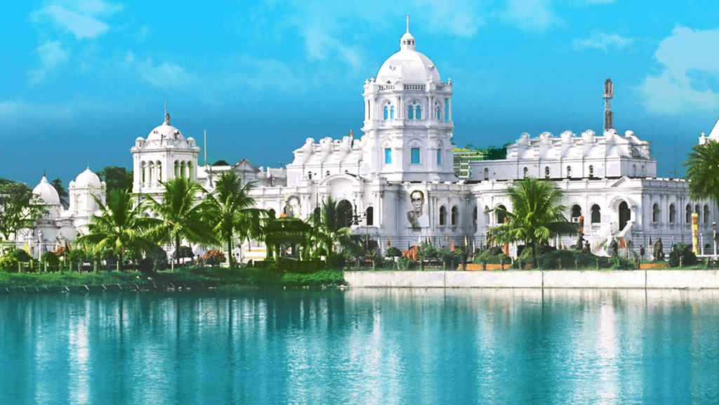
Ujjayanta Palace – This royal house, which stands in the capital city Agartala covering 1(one) sq. Km. area was built by Maharaja Radha Kishore Manikya during 1899-1901. It is a two storied mansion, having a mixed type of architecture with three high domes, the central one being 86’ high. The magnificent tile floor curved wooden ceiling and beautifully crafted doors are particularly notable. The palace is set with huge Mughal style gardens, beautified by pools and gardens. Flood lighting and fountains have also added to its beauty.
Visiting Hours: 10 a.m. to 1 p.m. and 2 p.m. to 5 p.m.
Closing day: Sunday and including all gazetted holidays.
Entrance: Rs. 2/- per ticket.
Kunjaban Palace – The Kunjaban Palace once known as the Pushbanta Palace was constructed in 1927 for the King Birendra Kishore Manikya is a tremendous repository which reflects the rich and aesthetic taste of the former ruler.
Jagannath Temple – Famous not only from the pilgrim’s point of view, this temple is also a remarkable architectural feat with its octagonal base and its impression pradhakshin patha round the sanctum. The pillars are crowned by square and pyramidal cones.
Uma Maheswar Temple – Located opposite to the Jagannatha Temple, Uma Maheshwar temple is expanded on the grass land of Ujjyanta Palace. The temple is Saffron in colour as the Jagannatha temple and has lavish green yards.
Fourteen Goddess Temple – Chaturdash Devata Temple is known as Fourteen Goddess Temple. This temple was built in honour of fourteen deities, together called the Chaturdasha Devata, by King Krishna Manikya Debbarma of Tripura and these deities are ceremoniously worshipped during Kharchi Puja. The Kokborok names of the fourteen deities are Lampra, Akhatra, Bikhatra, Burasa, Thumnairok, Bonirok, Sangroma, Mwtaikotor, Twima, Songram, Noksumwtai, Mailuma, Khuluma and Swkalmwtai.
Rabindra Kanan – Quietly nestled south of Raj Bhawan, the sprawling ‘Rabindra Kanan’, a park with lush greenery and an abundance of flowers, is home to children and young people, looking for a peaceful nest for heart-to-heart chatting. Apart from the colourful flowers, what heightens the beauty of the park is a ‘Puppet House’ for children who enormously enjoy the puppet shows. The visitors to the park draw a bonus in the form of delicious food served by the Assam Rifles canteen, west of it.
Sepahijala Wildlife Sanctuary – Sepahijala wildlife sanctuary encompasses an area of 18.54 sq. km. The sanctuary has not less than 456 plant species. Many kinds of bamboo and a variety of grasses and medicinal plants also grow in the sanctuary. It is here that one can find nearly 4500 cubic meters per hectare of timber biomass. More than 150 species of residential birds, migratory birds, orchid garden, boating facilities, wild life, botanical garden, zoo, elephant joy-rides, rubber and coffee plantations beckon the tourists all through the year. The added visual incentive for animal-lovers is the famous spectacled monkey which is now a rare species. It is closed on Thursday.
Tripura Sundari Temple at Udaipur – According to mythology, Lord Vishnu had cut off the body of Mata Sati into 51 pieces with his ‘Sudarshana Chakra’ and all these pieces fell at different places throughout the country and these places are known as ‘Shaktipeeths’. It is said that ‘right foot’ of Mata Sati fell at Matabari on the southwestern outskirts of Udaipur town, headquarter of present south Tripura district of the state. This ‘pithasthan’ (centre of pilgrimage) is also known as Kurma Pith because the shape of the temple premises resembles that of “Kurma” or tortoise. The idol of ‘Maa Kali’, presiding deity of the temple, stands in the sanctum sanctorum and it is made of reddish black stone, popularly known in Bengali as ‘Kashtipathar’.
Neermahal – Known as ‘Lake Palace’ of Tripura, Neer-Mahal was constructed as a summer residence. It was Maharaja Bir Bikram Manikya Bahadur’s idea to build a palace in the beautiful Rudrasagar Lake and in 1921 he accredited the British company Martin and Burns to construct the palace for him. The company took nine years to complete the work. Viewing Neermahal from the bank of Rudrasagar reminds one of the famous and enchanting ‘Jagniwas Palace’ in Pichola Lake at Udaipur, Rajasthan. It is a fascinating sight to view the reflection of the palace on the placid water of the Rudrasagar Lake. Facilities for boating and water sports are available and boat festival is held every year in Rudrasagar in the month of July/August.
Kamalasagar Lake – Kamalasagar is an artificial lake in Tripura, India, constructed by King Dhanya Manikya of Tripura in the 15th century and is a popular spot for picnickers. The Kamalasagar Kali Temple was also built on a hill-top by Maharaja Dhanya Manikya in the late 15th century. It is situated just beside the Bangladesh border; the lake in front of this temple rightly enhances its beauty. The name and fame of this Shakti Shrine draws substantial religious minded tourists from far and wide. The deity installed inside the temple is of goddess Durga but as the base platform has an image of Shiva, the ten handed Durga fighting the buffalo demon Mahisasur is worshiped as goddess Kali. The area where the temple is located is also known as Kasba which is a Farsi word is meaning a town. Every year a big fair is held near the temple in the month of April and thousands of devotees throng to offer their Puja in the temple.